
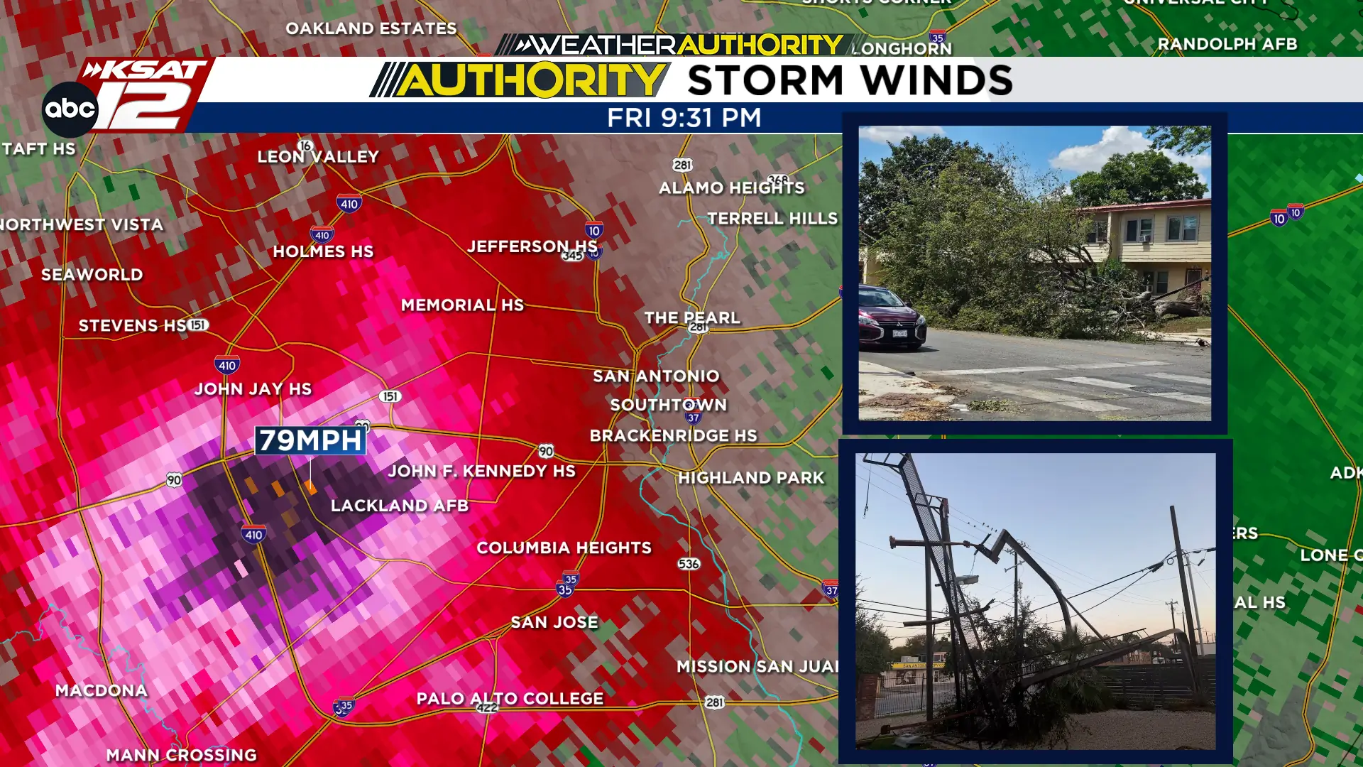
SAN ANTONIO – Powerful thunderstorms swept across the San Antonio area Friday evening, August 28, producing wind gusts approaching 80 mph and leaving a widespread trail of damage across Bexar County. While it may have felt like a tornado moved through, the damage Friday night *technically* was from straight-line winds, which can be just as damaging as a tornado.
At the height of the storm, nearly 100,000 CPS Energy customers lost electricity as strong winds and lightning damaged equipment. Flash flooding was also a major issue.
What caused the extreme winds
Friday night’s event was a severe thunderstorm with severe straight-line winds. There is a possibility that wind speeds were enhanced by a downburst and additional thunderstorms developing along an outflow boundary. Meteorologist Justin Horne explains what a downburst is in the video below.
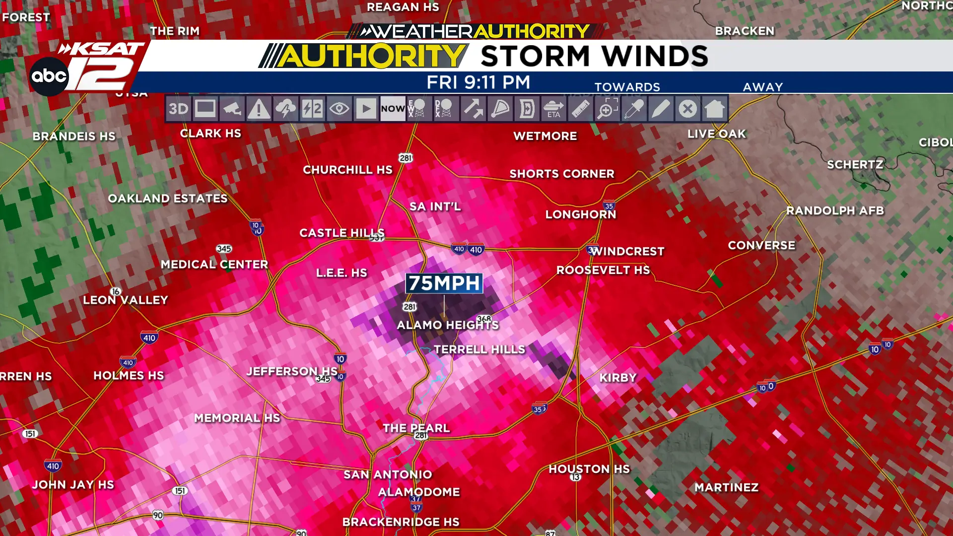
The strongest official wind gust recorded at San Antonio International Airport reached 52 mph as a line of severe thunderstorms moved through. However, the most intense winds occurred just south of the airport. Our radar indicates the Alamo Heights neighborhood could have received gusts up to 75 mph.
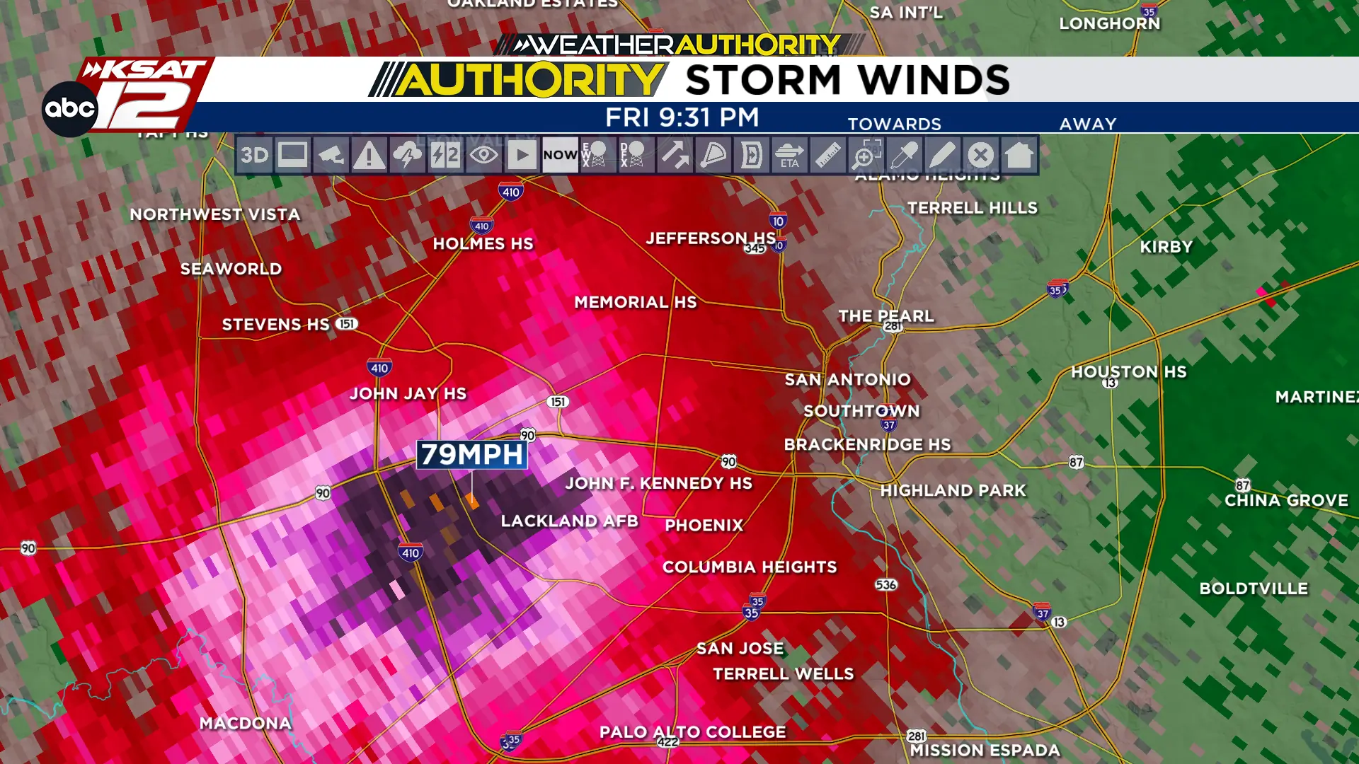
The winds continued to forcefully move through San Antonio over the next half hour. Towards the West Side, near Lackland Air Force Base, more trees were toppled and structures were damaged with wind gusts near 80 mph. This knocked out power to tens of thousands of residents and created hazardous travel conditions across the city.
Resources
Cleanup efforts are underway as crews work to remove debris and restore power.
>> Resources available for San Antonio residents after storms
To view the latest weather updates, you can click here.

A collection of daily blog posts from the KSAT Weather Authority.
- Read more from the meteorologists on the Whatever the Weather page
- Download KSAT’s weather app for customized, accurate forecasts in San Antonio, South Texas or wherever you are
- Find the latest forecasts, radar and alerts on the KSAT Weather Authority page

