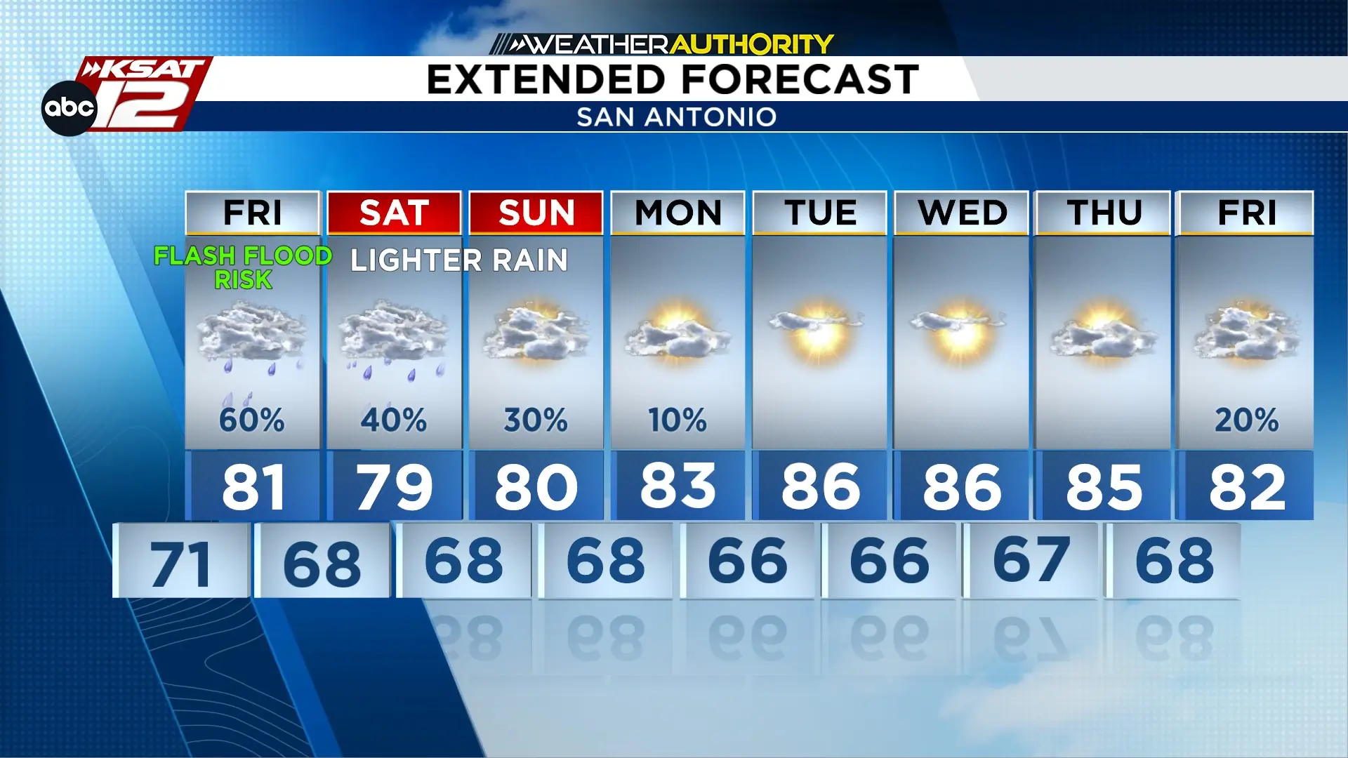
FRIDAY: Intermittent rain, street flooding possible
FLASH FLOOD WATCH: For Bexar, Atascosa, and Wilson Counties until 7pm Friday
MAIN CONCERN: Low water crossings
POTENTIAL IMPACT TO: Afternoon commute & after-school activities
WEEKEND: Intermittent light rain in spots, no flooding risk
Street flooding is the main concern in urban areas, while we will closely monitor creeks and streams.
FORECAST
Flood Watch through 7pm Friday.
EVENING
A break in the heavy rain this evening should lead to new downpours developing overnight, which could lead to additional flash flooding. The primary concern overnight and through the Friday morning commute will be road travel and the typically flood prone roadways.
OVERNIGHT INTO FRIDAY MORNING
While rain Friday morning could lead to additional flooding and problems for the morning commute, rain will lighten during the second half of the day with much lower lightning chances.
SHOWERS THIS WEEKEND
More scattered activity is expected over the weekend, but activity will be light and intermittent, so flooding is not a concern. Fall-like weather is in the forecast for next week.
Flash flooding (mainly of roadways) possible through 7pm Friday. Much lighter rain coming and going Friday evening through the weekend. (Copyright 2024 by KSAT - All rights reserved.)
Daily Forecast
KSAT meteorologists keep you on top of the ever-changing South Texas weather.
Sarah Spivey is a San Antonio native who grew up watching KSAT. She has been a proud member of the KSAT Weather Authority Team since 2017.
Sarah is a Clark High School and Texas A&M University graduate. She previously worked at KTEN News.
When Sarah is not busy forecasting, she enjoys hanging out with her husband and cat, and playing music.
Justin Horne is a meteorologist and reporter for KSAT 12 News. When severe weather rolls through, Justin will hop in the KSAT 12 Storm Chaser to safely bring you the latest weather conditions from across South Texas. On top of delivering an accurate forecast, Justin often reports on one of his favorite topics: Texas history.