
FORECAST HIGHLIGHTS
- TWO MORE DAYS OF HEAT: Today, Wednesday will still see highs in the mid-90s
- WHEN WILL RAIN BEGIN?: Isolated chances Wednesday, rainfall becomes likely on Thursday
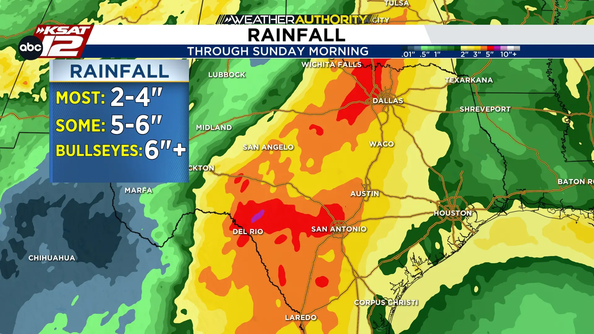
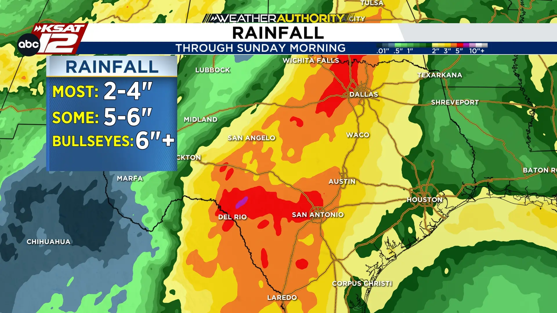
- HOW MUCH?: 2-5″ possible, however, isolated spots could see more than 6″ of rainfall
- WHEN WILL RAIN END?: Rain will become lighter over the weekend, with chances ending late Sunday
FORECAST
TODAY -- GENERALLY QUIET
Temperatures will soar again today into the mid-90s, with humidity and partly cloudy skies. A shower can’t be ruled out this afternoon, mainly east of I-35.
WEDNESDAY (9/30) -- STORMS OUT WEST
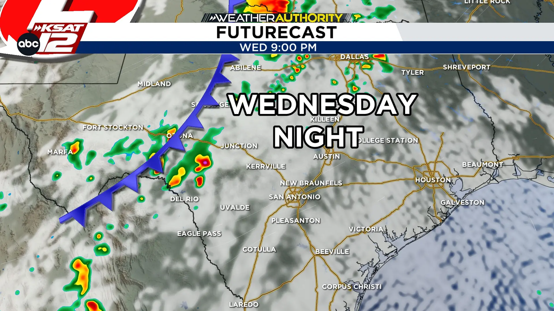
Wednesday will be a transition day, as the storm system pulls into the Texas. A few showers will be possible Wednesday morning along the Rio Grande. Then, by Wednesday afternoon, storms will take shape west of San Antonio along a slow-moving front. A few of these storms could be strong to severe. As the storms move east, heavy rainfall will become the bigger threat.
THURSDAY (10/1) -- HEAVY RAIN LIKELY
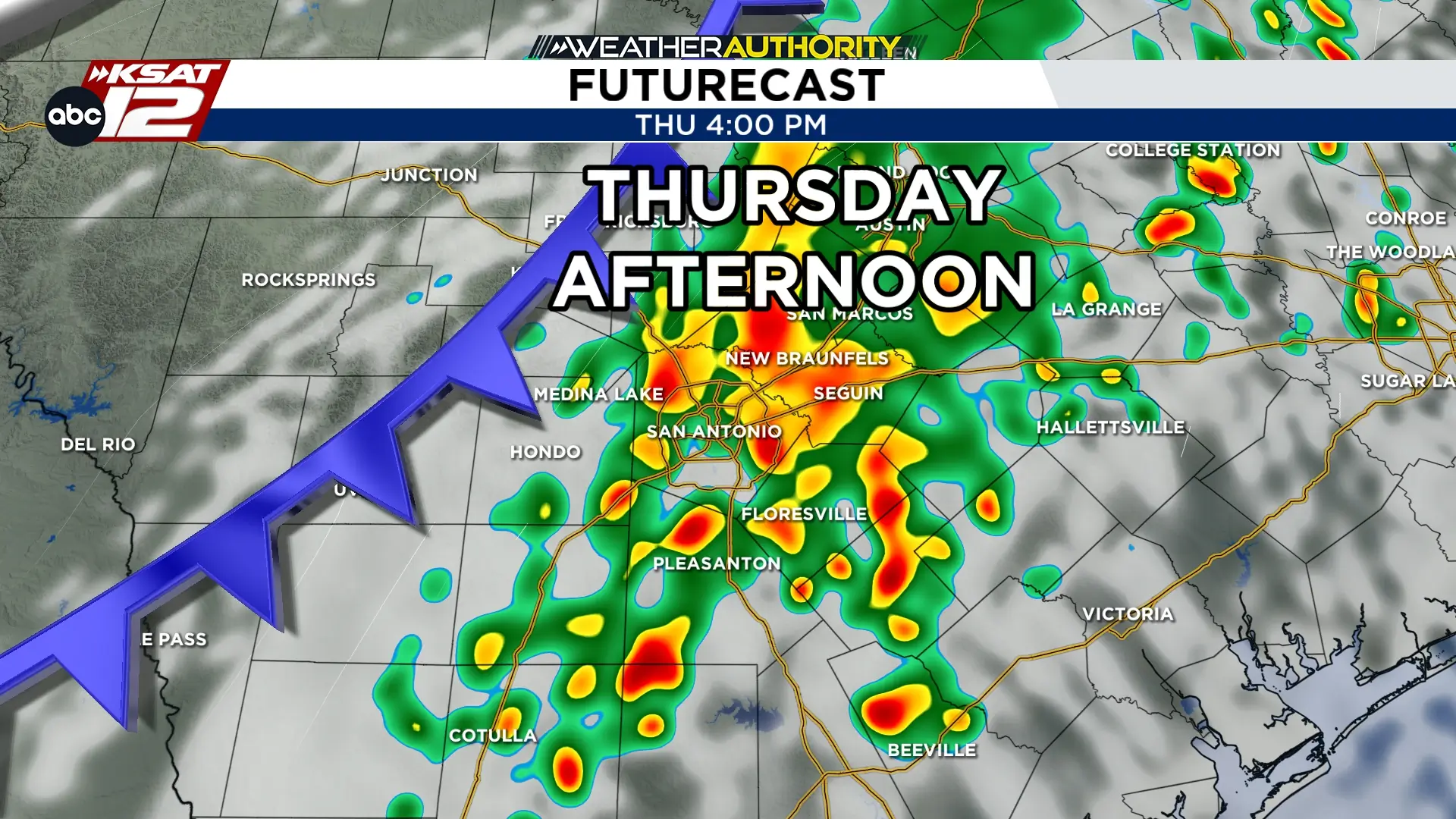
The front will slowly make its way toward San Antonio on Thursday, with storms almost a sure bet by Thursday afternoon. Heavy rainfall and street flooding is a risk. Abundant moisture and training of storms could create isolated rainfall of 6″+ somewhere across the area. However, most will see totals in the 2-5″ range.
FRIDAY (10/2) -- RAIN LIKELY
The front should slowly move south and east, pushing the threat for the heaviest rainfall south of San Antonio on Friday. However, showers and a storm or two is still possible during the day on Friday. Any additional rainfall could aggravate flooding issues.
THIS WEEKEND -- LIGHTER RAIN, LOWER CHANCES
Lighter rainfall is expected over the weekend, before chances come to an end early next week.


KSAT meteorologists keep you on top of the ever-changing South Texas weather.
QUICK WEATHER LINKS
- Download FREE KSAT Weather Authority App: Up-to-date forecast information and livestreams from trusted local meteorologists.
- KSAT Connect: Share your weather photos.
