
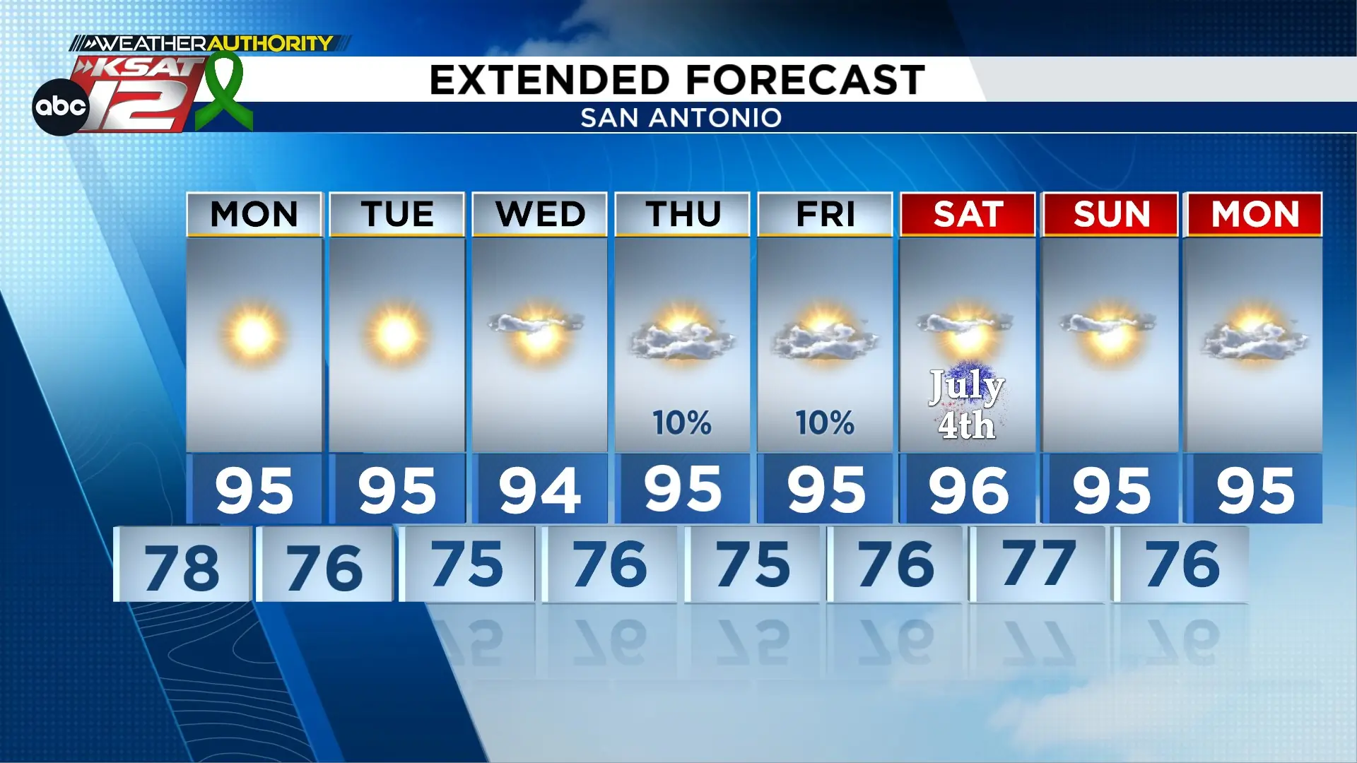
FORECAST HIGHLIGHTS
- SAHARAN DUST: Thick plume of Saharan Dust arrives, thickest on Monday
- JULY 4TH: Hot, mostly sunny, and low rain chances
- EXTENDED OUTLOOK: Staying steady in the 90s
FORECAST
MONDAY
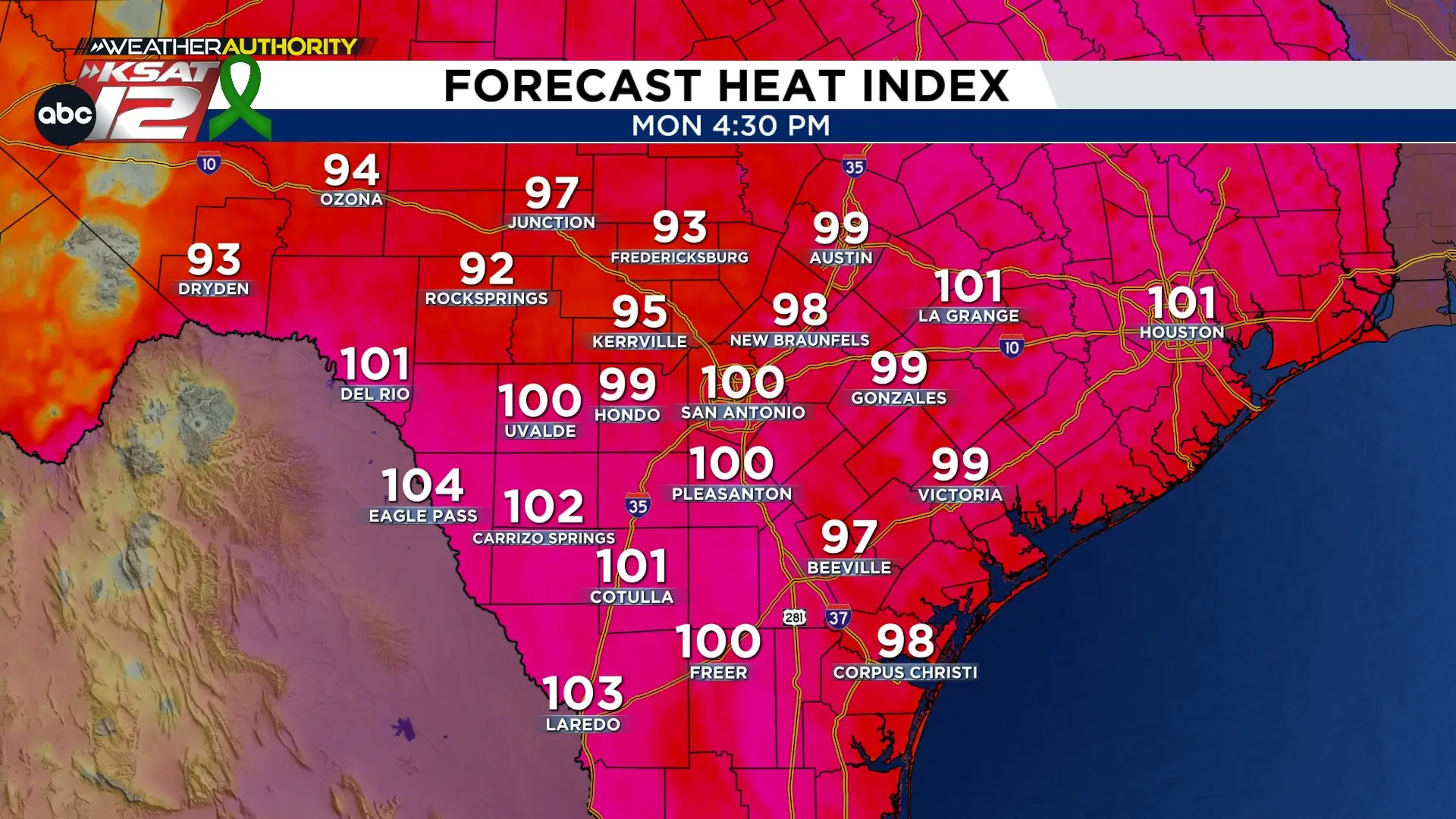
South-Central Texas continues a hot, dry pattern into July. Expect highs in the mid-to-upper 90s, with some areas hitting 100 degrees. South winds will gust near 20–30 mph, while humidity will push heat index values near and above 100 degrees again.
EXTENDED OUTLOOK
Little change is expected as South-Central Texas heads into the first week of July. High pressure will remain the dominant weather feature, keeping conditions hot, mostly sunny, and dry across the region.
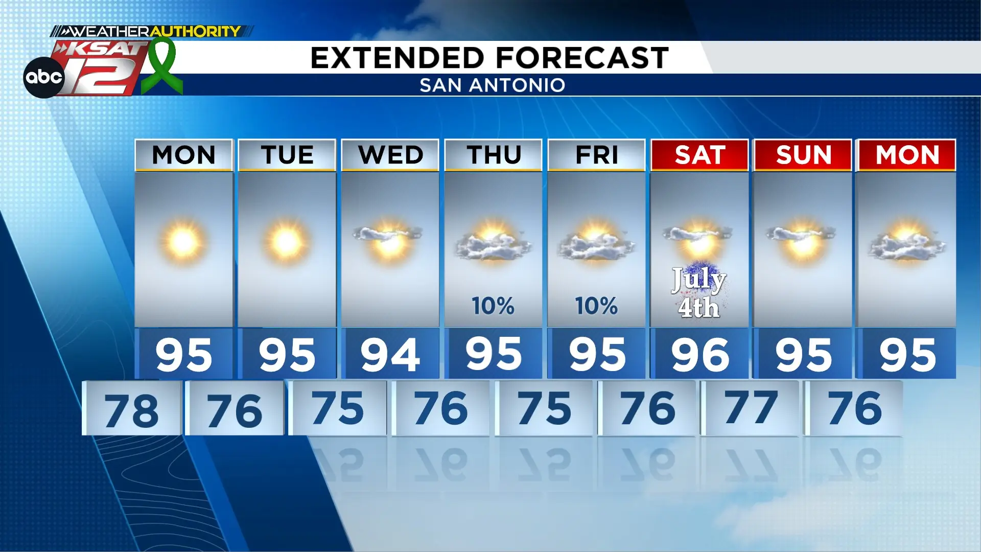
Although weather patterns may become slightly more favorable for isolated showers later in the week, most forecast guidance continues to keep rain chances below 10 percent. Our weather focus will remain on the prolonged stretch of heat, with daily heat index values approaching or exceeding 100 degrees nearly every afternoon.
JULY 4TH SNEAK PEAK
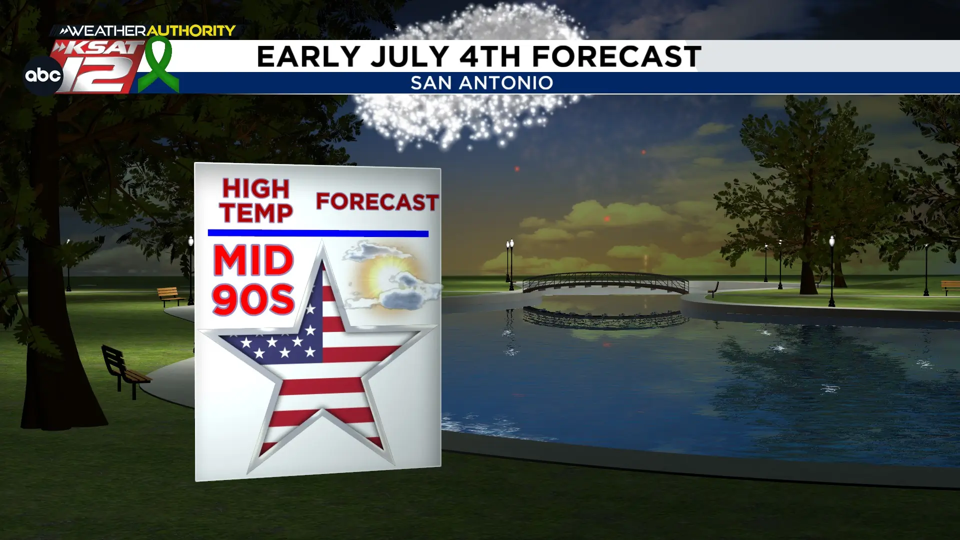
If you’re making plans for Independence Day, the forecast is shaping up well for outdoor celebrations. Hot, mostly sunny, and dry weather is expected across South-Central Texas, with afternoon highs in the mid 90s and heat index values climbing into the upper 90s and lower 100s. With minimal rain chances in the forecast, conditions will be favorable for parades, barbecues, and evening fireworks displays.

KSAT meteorologists keep you on top of the ever-changing South Texas weather.
QUICK WEATHER LINKS
- Download FREE KSAT Weather Authority App: Up-to-date forecast information and livestreams from trusted local meteorologists.
- KSAT Connect: Share your weather photos.

