Slight chance of rain as our weather pattern shifts a bit this weekend. (Copyright 2024 by KSAT - All rights reserved.)
FORECAST HIGHLIGHTS
THIS WEEK: Upper 90s to near 100°
WEEKEND: Spotty rain (30%), mainly in the Hill Country
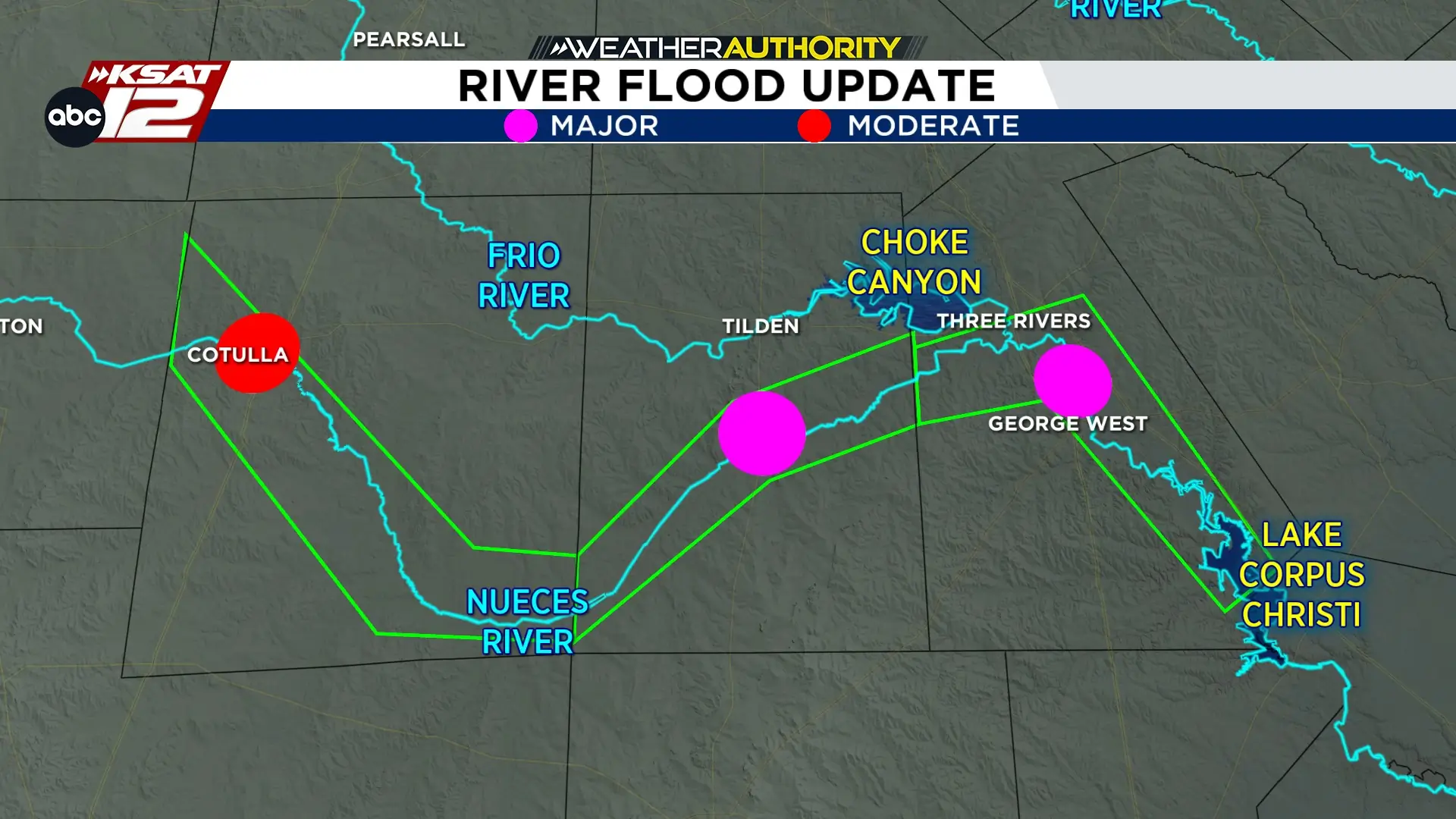
NUECES RIVER: Continues to flood in McMullen Co., will flood at major stage soon in Live Oak County
FORECAST
After a stretch of near average temperatures, we’ll add a few degrees to the afternoon highs in the days ahead with triple digits likely by Friday and especially the weekend in San Antonio.
RAIN CHANCES
The upper-level “heat high” will drift west by this weekend opening the door to upper energy and a weak frontal boundary, which could trigger a few showers and storms - particularly in the Hill Country. However, this is not a situation where flooding is a threat.
Isolated showers and storms possible Saturday evening - particularly in the Hill Country. (Copyright 2024 by KSAT - All rights reserved.)
RIVER UPDATES
River flooding continues along the Nueces from rains 2 weeks ago (Copyright KSAT-12 2026 - All Rights Reserved)
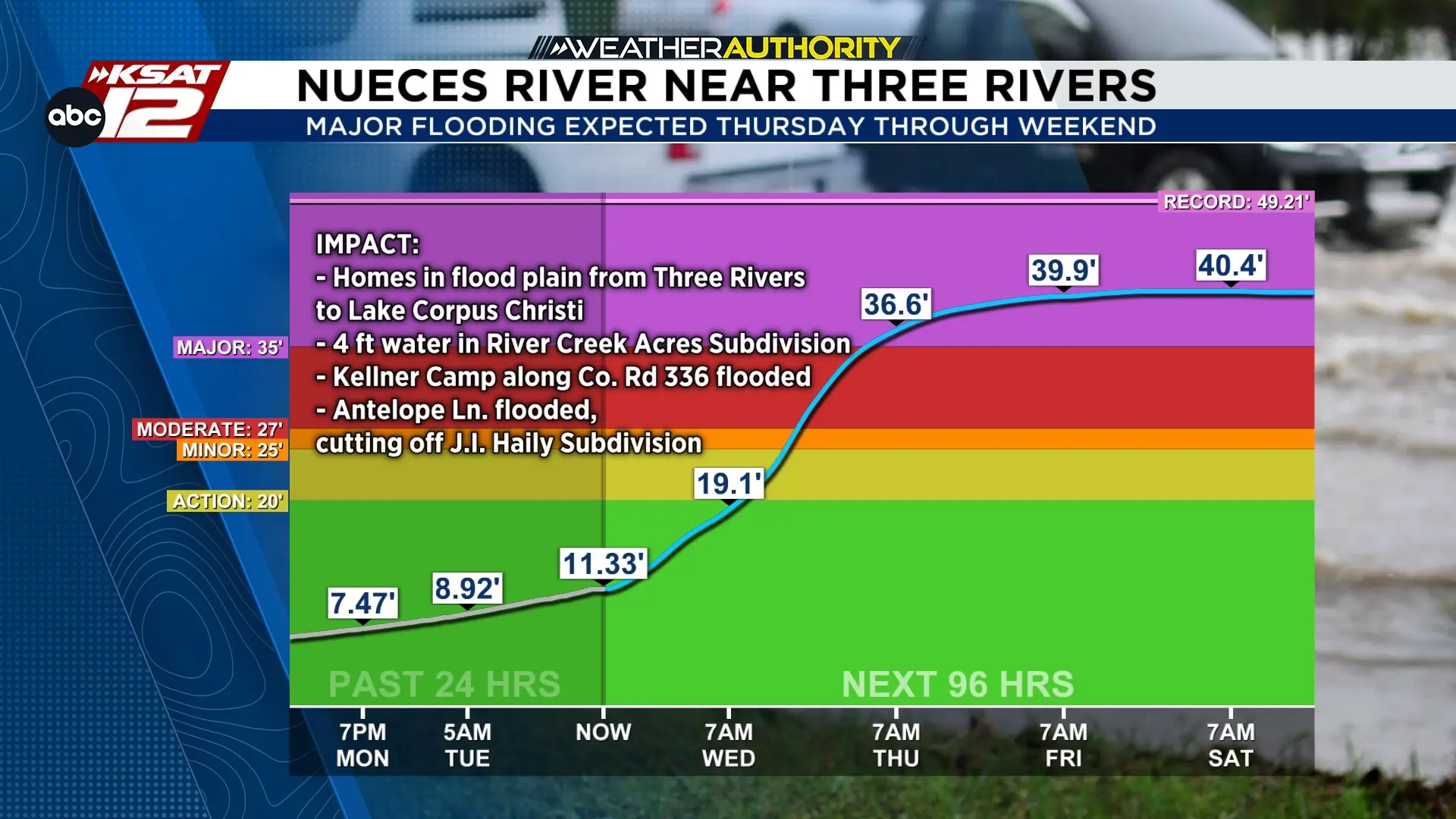
Even though the weather is calm, the Nueces River is still dealing with major flooding from the rain two weeks ago. Water levels are finally starting to drop near Cotulla, but the flood crest is still heading downstream. It’ll reach major flood stage near Three Rivers to George West from Thursday through at least the weekend.
If you’re in Three Rivers or George West, please stay alert and make sure to follow any instructions from local officials. This flood will be a couple of feet higher than the flood of 2013, cresting near 40 ft.
Nueces river near Three Rivers is expected to hit major flood stage starting Thursday morning. (Copyright 2024 by KSAT - All rights reserved.)
Daily Forecast
KSAT meteorologists keep you on top of the ever-changing South Texas weather.
Sarah Spivey is a San Antonio native who grew up watching KSAT. She has been a proud member of the KSAT Weather Authority Team since 2017.
Sarah is a Clark High School and Texas A&M University graduate. She previously worked at KTEN News.
When Sarah is not busy forecasting, she enjoys hanging out with her husband and cat, and playing music.
Shelby Ebertowski joined KSAT 12 News in January 2025. She came to San Antonio from Fargo, North Dakota via the University of North Dakota, where she learned the ropes as a weekend forecaster over two years at KVLY. Her love of weather love began after experiencing Hurricane Harvey in 2017.