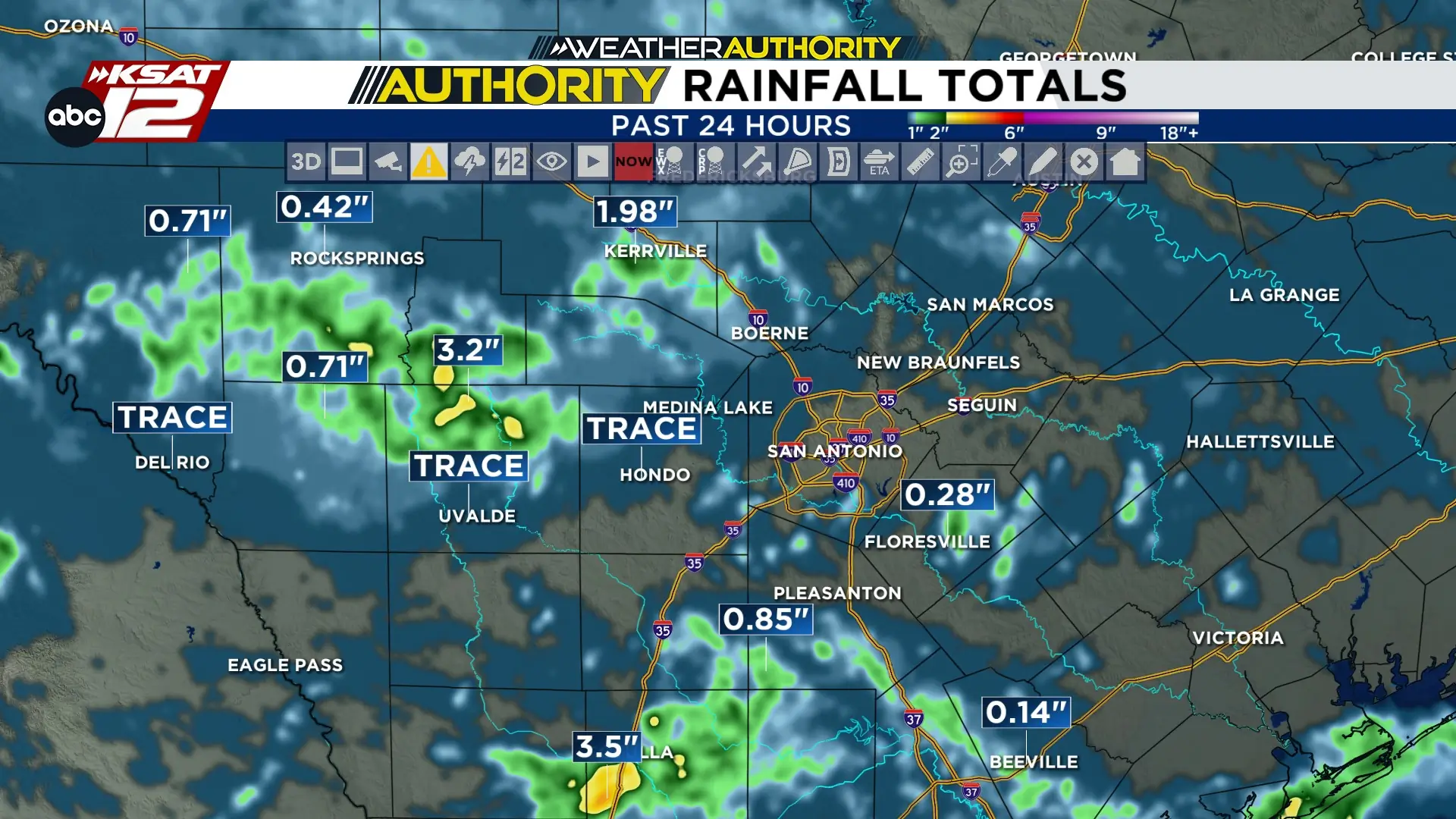
RAINFALL TOTALS: Heaviest rain totaled near4″ over the past 24 hours.
TODAY: Highs returning to the upper 90s and near 100 degrees.
THIS WEEK: Hot, mostly sunny, and rain chances remain limited.
FORECAST
RAINFALL TOTALS
Saturday’s and Sunday morning’s storms brought heavy rain to the Hill Country and Rio Grande Plains. Over 3 inches were recorded in parts of Edwards, Real, Uvalde, and Kinney counties. Accumulations in La Salle county were close to 4″.
Rainfall totals as of 9 am. (Copyright KSAT-12 2026 - All Rights Reserved)
SAHARAN DUST
Dust looks to make a return this week between Tuesday and Wednesday. Coastal areas will see more dust than the rest of us on Wednesday, but we’ll have the haze clear up by Thursday.
A plume of Saharan dust arrives Tuesday. (Copyright 2026 by KSAT - All rights reserved.)
HOT & DRY
A hot, dry pattern returns as high pressure builds, bringing sunshine and highs near 100°F next week. Aside from slight humidity increases and isolated coastal showers mid-week, widespread rain is not expected.
Your Weather Authority Extended Forecast. (Copyright 2026 by KSAT - All rights reserved.)
Daily Forecast
KSAT meteorologists keep you on top of the ever-changing South Texas weather.
Shelby Ebertowski joined KSAT 12 News in January 2025. She came to San Antonio from Fargo, North Dakota via the University of North Dakota, where she learned the ropes as a weekend forecaster over two years at KVLY. Her love of weather love began after experiencing Hurricane Harvey in 2017.
Leah Rodriguez joined the Weather Authority Team in 2026 after watching KSAT 12 while growing up in Pearsall. She graduated with a Bachelor's Degree in Meteorology from Texas A&M University and worked in Lubbock for two years.
When she's not watching the radar, Leah enjoys spending time with her family and her dog Luby.