
FORECAST HIGHLIGHTS
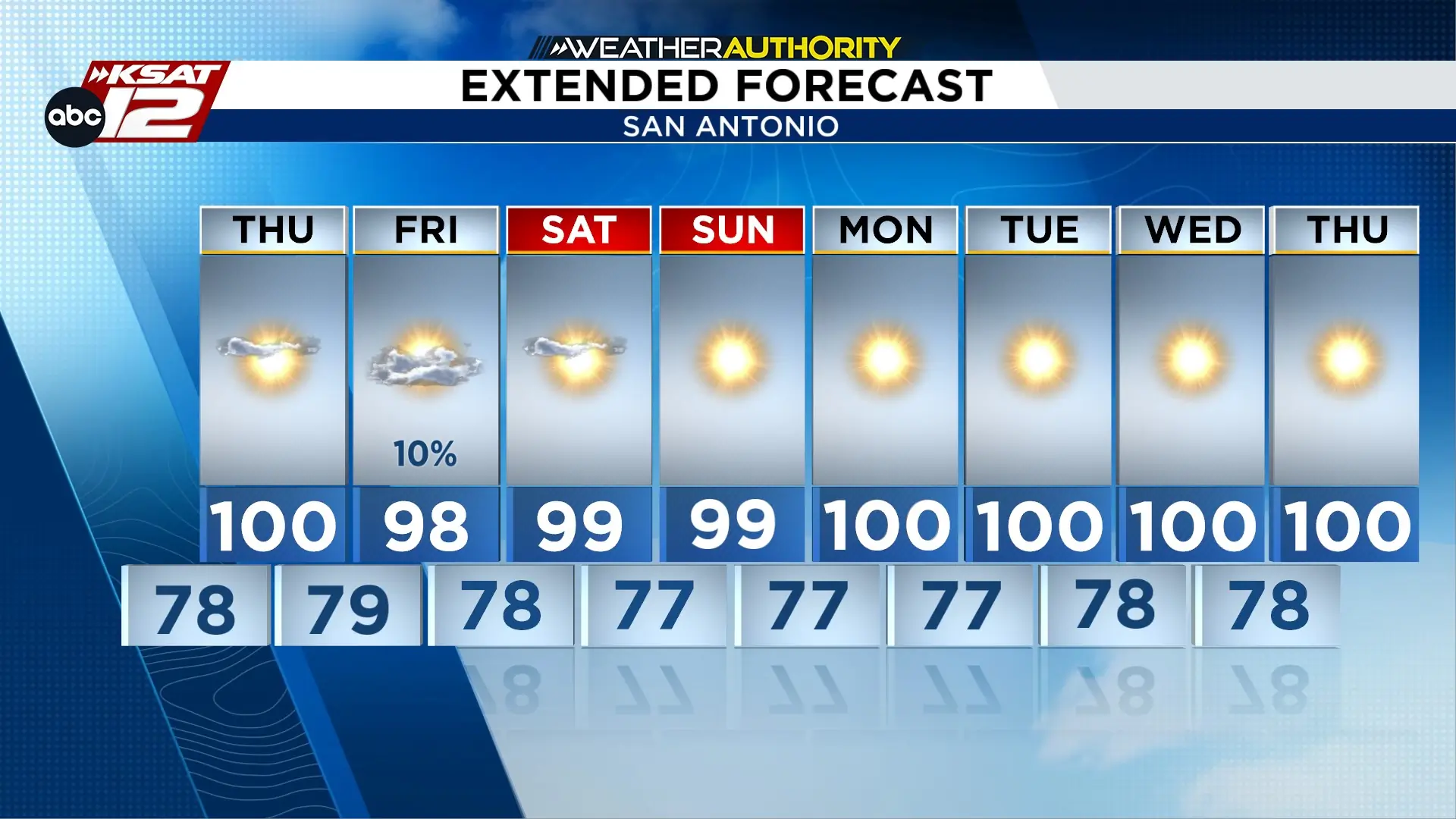
- AUGUST HEAT: Temps will be running a few degrees above average
- FRIDAY: 10%-20% chance of rain
- ACTIVE TROPICS: New development expected
FORECAST
AUGUST HEAT
In typical August form, we’ll be running hot over the next two weeks. Today was our second triple digit day (101) so far this year, and we will tally up more in the days ahead.
SMALL SHOT AT RAIN FRIDAY
On Friday, a small disturbance will move overhead, and this could stir up a shower or two, but San Antonio’s rain chances will stay around 10%-20%.
ACTIVE ATLANTIC
The tropics are staying more active than the weather around Texas! Two disturbances have developed in the Atlantic, one which could become a tropical depression soon. Currently, it’s forecast to move west, reaching the windward islands by the weekend. It’s still too early to tell where it will move beyond that.
In the northern Atlantic, Tropical Storm Cristobal has become official. This storm formed over open ocean and is not expected to impact any land before it dies out by midday Thursday.


KSAT meteorologists keep you on top of the ever-changing South Texas weather.
QUICK WEATHER LINKS
- Download FREE KSAT Weather Authority App: Up-to-date forecast information and livestreams from trusted local meteorologists.
- KSAT Connect: Share your weather photos.

