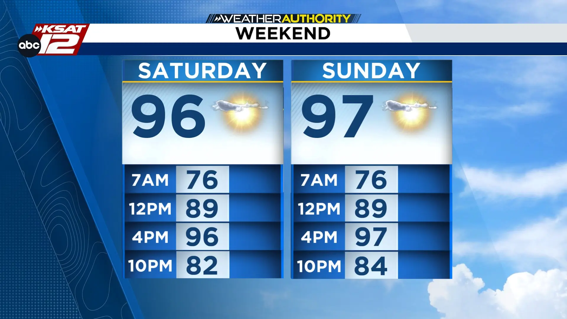
Sunny and seasonable weekend. (Copyright 2024 by KSAT - All rights reserved.)
FORECAST HIGHLIGHTS
TONIGHT: Clear, quiet, and seasonable
WEEKEND: Sunny and dry, mid to upper 90s
NEXT WEEK: Back near 100°
NUECES & FRIO RIVERS: Continue to flood near Cotulla & Tilden
FORECAST
WEEKEND
Early morning clouds will give way to sunshine for most of Saturday as afternoon temperatures reach the mid 90s.
Slightly warmer Sunday, with a high in the upper 90s.
Enjoy time by the local pool, splashpad, or river knowing rain will not be a factor this weekend.
NEXT WEEK
The heat high settles over, and we’ll have a typical end-of-July weather pattern: Hot and sunny with highs near or just above 100°.
Sunny and dry as we gradually get back to triple digits. (Copyright 2024 by KSAT - All rights reserved.)
NUECES & FRIO RIVERS
It is taking a long time for the nearly 500 billion gallons of water that fell last week to drain into Choke Canyon and Lake Corpus Christi along the Nueces and Frio Rivers. Areas of Cotulla and Tilden along the rivers are still flooded. Cotulla, and folks downstream along the Nueces, can expect the river to remain at major flood stage through the weekend.
Daily Forecast
KSAT meteorologists keep you on top of the ever-changing South Texas weather.
Sarah Spivey is a San Antonio native who grew up watching KSAT. She has been a proud member of the KSAT Weather Authority Team since 2017.
Sarah is a Clark High School and Texas A&M University graduate. She previously worked at KTEN News.
When Sarah is not busy forecasting, she enjoys hanging out with her husband and cat, and playing music.
Leah Rodriguez joined the Weather Authority Team in 2026 after watching KSAT 12 while growing up in Pearsall. She graduated with a Bachelor's Degree in Meteorology from Texas A&M University and worked in Lubbock for two years.
When she's not watching the radar, Leah enjoys spending time with her family and her dog Luby.